
A winter with hardly any snow made it possible to plan a long day tour in early January, which usually is only something in this extent for other seasons. Making the best of trains, it was a long 30 km and 2000 vertical metres to cross from the Almtal to Kremstal. The whole path was extremely divers and landscape-wise much better than expected. The idea was more to combine the two valleys, but the views were just stunning as well. At the end I'll try to give several shorter options, all starting than from the same point, for having the most beautiful parts without an excessive day tour. For everyone being fit, I can only recommend our option.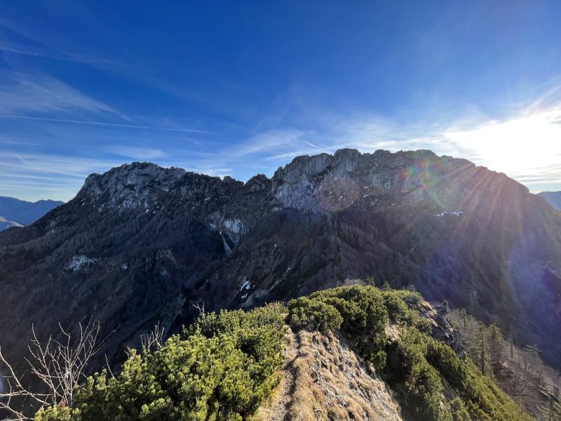

Source.
Transport
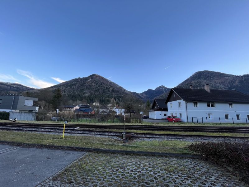
Taking the train from Linz, via Wels, to Scharnstein, destination Grünau. Doable as well from Vienna, as there's a Railjet connection to Wels suitable for the regional train. I left Linz around 7:30 and arrived in Scharnstein at 8:44.
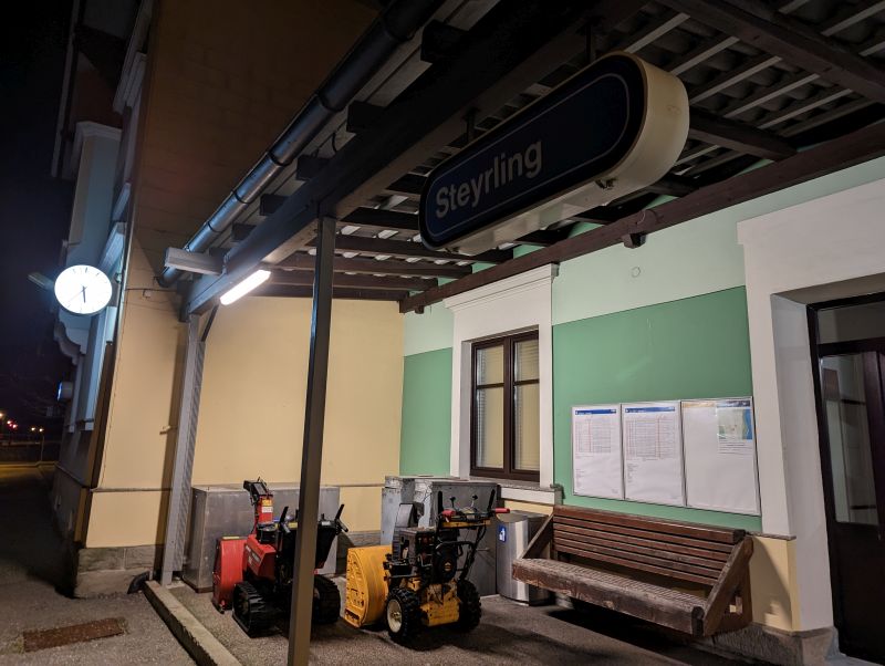
For the return there is the shorter option via station Micheldorf, or a bit longer, it includes an additional 4 km to the station, but more sunny to Steyrling. We chose the latter and did not regret it. The connections to Linz (around 1 h) are with approximately every hour also frequent. Station of Steyrling also has toilets, but nothing to buy stuff or to eat.
Hike
The whole trail is impressively well-marked, mostly it's just following signs, flags and the logical direction. Nonetheless, we missed the path sometimes, turning around or sliding through the forest solved the issue. Easier and probably more recommendable is, keeping the markings in sight and following them, if you don't see any, just return to the last one.
From Scharnstein Bahnhof (as well has a parking lot) walk towards the signs of Geyerhammer, ruin Scharnstein and Hochsalm. 
Top: Maisenkögerl is the hill to the left, Hochsalm the rocky top in the middle, both are destinations of the day. Bottom: ignoring the sign for Maisenkögerl, but walking to the ruin and just from here up to Maisenkögerl.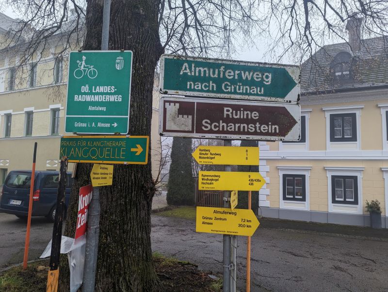
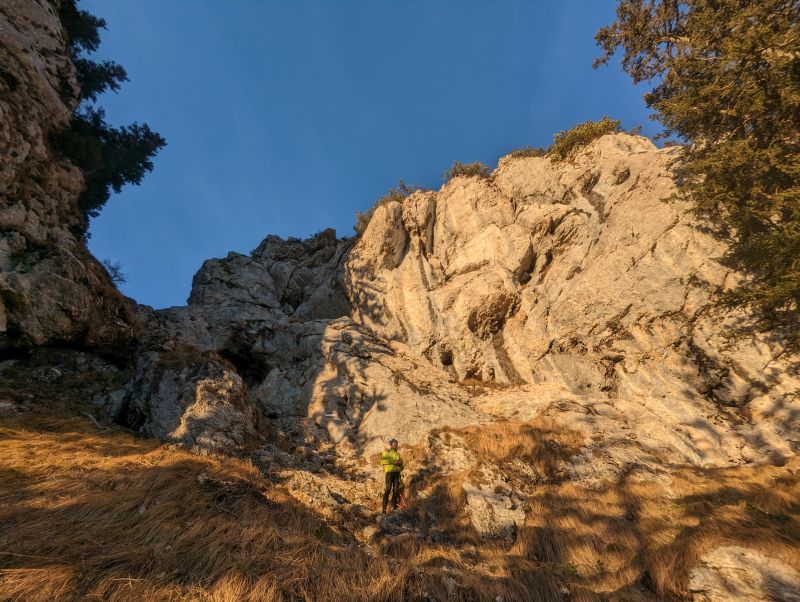
At a parking lot around the ruin, there is a non-marked trail through the forest via Bräumauer to Maisenkögerl.
To the back you are coming from, to the left is the ruin and for the Maiskögerl you turn here direction of walking left. On the picture, where the person stands, just follow the forest trail, here is the only part without markings.
To the peak it is short, secured with a chain, scrambling to the top. Already during the way up the ruin becomes better and better visible and the view opens towards Traunstein and Totes Gebirge. After the summit you continue the same direction, towards the east, to Hochsalm, very soon the first signs indicate that you're on the right path.
Scharnstein ruin, constructed in the 12th century. Since the 17th century it belongs to Kremsmünster Abbey.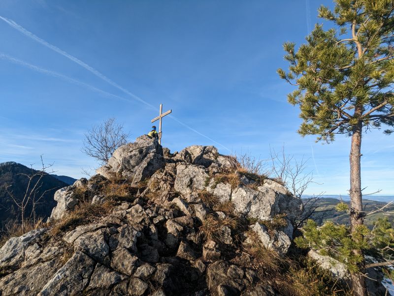
Peak of Maisenkögerl. On the lower picture, a bit left of the tree, the chain is visible. In overall easy climbing up.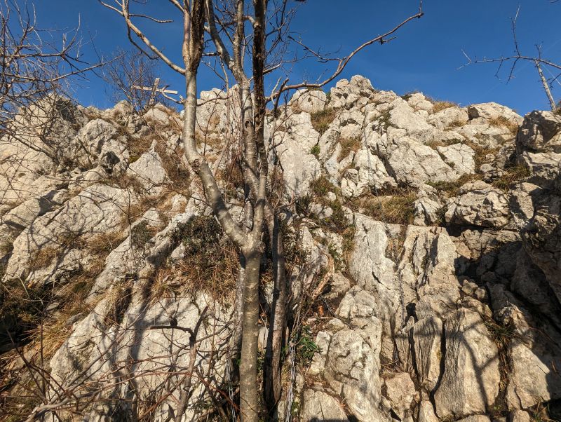
The people maintaining these paths did a great job with bringing humour and joy into the signs, and many are with funny and motivating words. Of course, another cross and views are welcoming you (except if you do it during bad weather, then just the cross). If you're happy with your daily load, just walking a few metres back and then turning left, and it will be a nice round-trip as well. Suitable for all seasons as it is mainly through forests.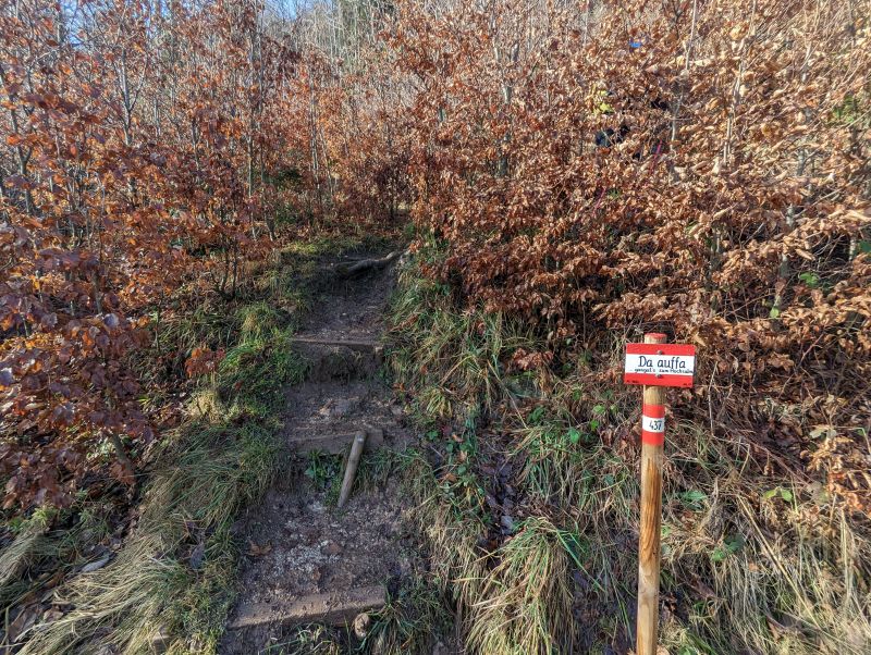
"Auffa", Upper Austrian dialect for: up here (to Hochsalm).
Up: view to the South West, Totes Gebirge, Höllengebirge, Traunstein. Down: Summit cross of Hochsalm with a view towards the North, Linz, Danube area, as usual in Winter, still foggy.

Otherwise, just follow the ridge, direction Zimmerter Brunnen and Mittagsstein, to reach Mittagsstein it should take around 1.5 h, with faster pace it's doable as well in an 1 h. Always obvious signs at every crossroad and on the way through the forest many flags on the trees. You pass as well a small cute chapel and the Zimmerter Brunnen/well, during winter hardly water though. 
Top: Mittagsstein peak. Bottom: on the way down from Mittagsstein, in the left back: Totes Gebirge with Großer Priel.

After Mittagsstein the next stop is Pfannstein, here was the first time, that we failed several times. In the beginning it's along the (not exposed) ridge, then more through the forest. Just keep the flags in mind and turn around if you don't see any, theoretically it should be easy, if one pays attention.
To Pfannstein, there should lead a direct path also from the West. At least we have not seen it, so we followed the trail and after already passing the Pfannstein the trail leads from the East easily up to the summit. The cool thing throughout the day is, how the Kremsmauer gets closer and closer. In the beginning, it seems so far away, but then one is nearly there.
Top: View to Kremsmauer. For Pfannstein follow the trail in the grass, keep right when descending and then going up again to ascent from the East. Bottom: summit cross of Pfannstein.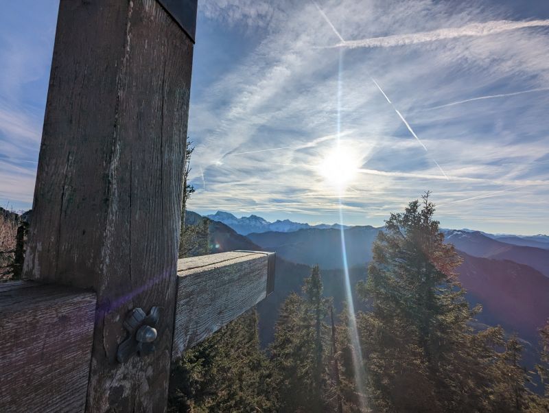
Down the same path and just continuing, approaching the Kremsmauer via Nackter Kalbing. Very scenic ridge, one of the highlights next to the rough walls of Kremsmauer.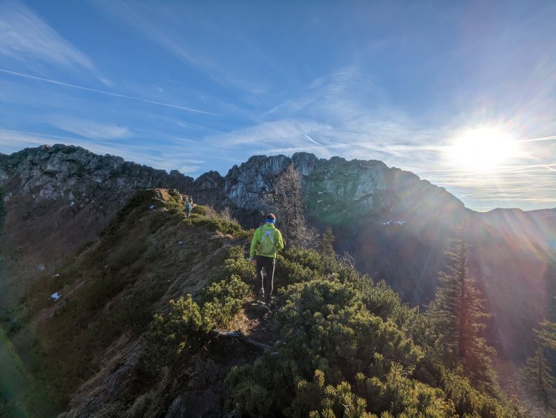


At the next crossroad, there is the decision if you want to continue to the Kremsmauertörl/saddle or just directly down to the source of Krems and train station of Micheldorf. Micheldorf is shorter, more interesting is the Törl, but that is something to decide on the spot. If you feel exhausted, rather descend, the hike up to Törl involves lots of scrambling and rope-secured parts. The top tough gives best views towards the mountains between Kleiner and Großer Priel.


In case you have even more motivation and stamina, now you could add the summit of Kremsmauer, which we did not do. We just descended quickly to catch the train at 6 pm. The time estimation given is till the town of Steyrling, for the train station it is another 4 km walk extra. After reaching the valley, there is the Kaltau, beautiful meadows and very calm area. The further path is just a descending forest track, easy to run several parts to gain some time advantage in case the train might be a close call. 


In Steyrling there seemed not to be too much life going on, the restaurant appeared to be closed. To the station there are various options: following bike tracks, following road and hitch-hiking, but best in my opinion is, following the sign to Waldweg (forest path) to Bahnhof. Walking towards the forest and a forest track to the station, it was with a headlamp also no problem during dark.
When reaching the station, you just need to wait for the train. Better checking the schedule ahead, for not missing one by a small margin.
Shorter Option 1: Scharnstein- Maisenkögerl- Hochsalm- Scharnstein: 12 km, ↕1000 m
Shorter Option 2: Station Micheldorf- Pfannstein- Nackter Kalbling- Micheldorf: 20 km, ↕1100 m.
Shorter with car and parking at parking lot (number 2 on the map).
Shorter Option 3: Mixture of option 2 and my original path: Micheldorf- Pfannstein- Nackter Kalbling- Törl- Steyrling: longer but more rewarding than option 2: 23 km, ↕1350 m