Usually in April, especially in the lower areas, the snow is getting less and less and if you belong to the spring ski touring faction, then there is either the chance of something high alpine or northern couloirs. With temperatures around 25 degrees in the valley, we decided to go from Salzburg to Watzmann and give its northern couloir a go. It takes quite a bit of dedication, as it is more cycling than skiing with this amount of snow. For us, it was 900m uphill on the bike with skis on the back, often having to get off the bike, then about 200m uphill on foot and then about 650m up to either the Watzmannkind or the saddle, whichever you prefer.
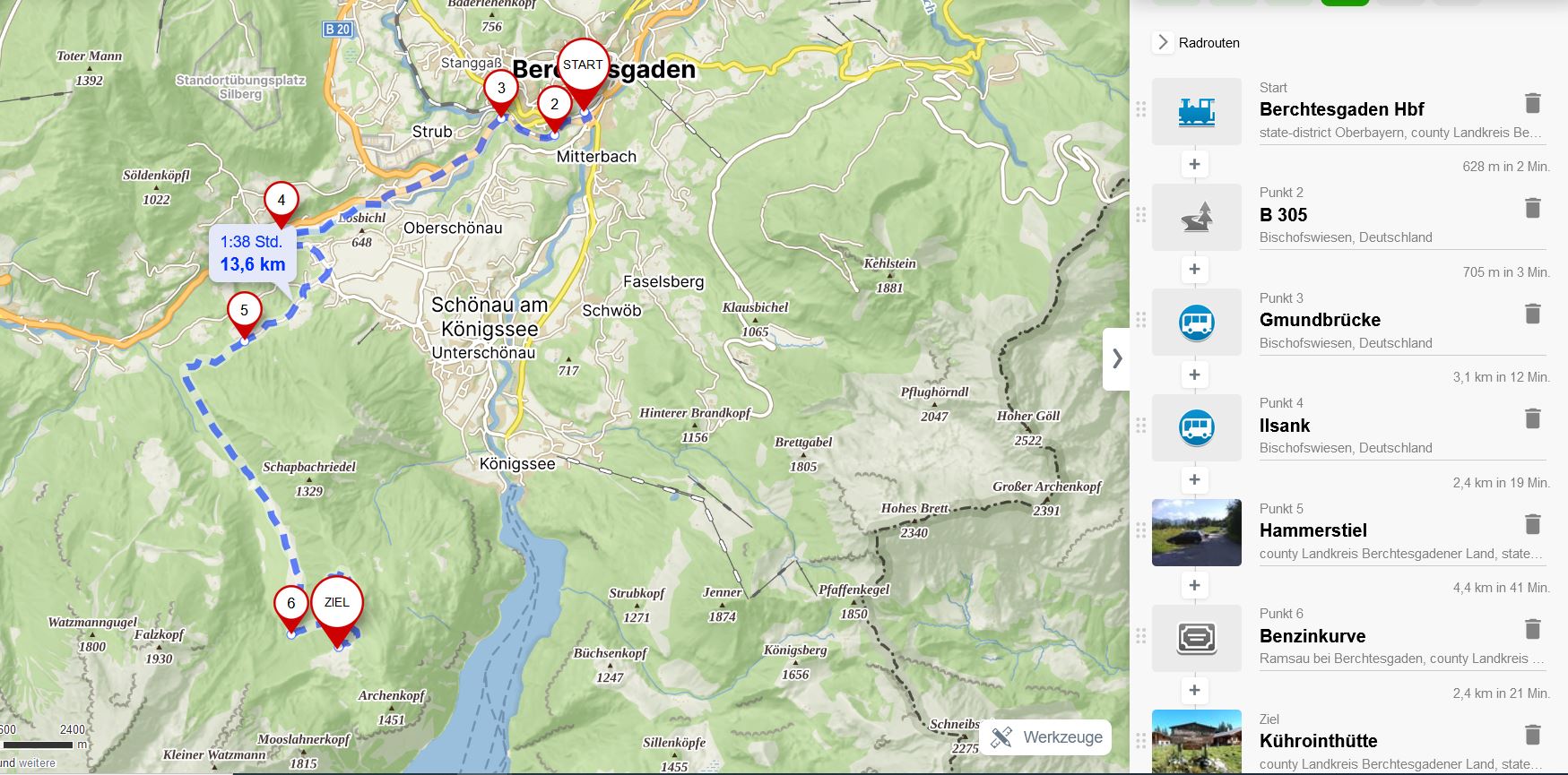
Source mapy.cz and editable version: train to Berchtesgaden, with the bike along the road/river to parking lot Hammerstiel, further biking to alp Kühroint.
How to get there
Salzburg - Freilassing - Berchtesgaden
The train to Berchtesgaden leaves from Freilassing, so you can either take the train from Salzburg or cycle to Freilassing in the morning. We chose the latter because it is only twice as far as Salzburg Central Station, everything is on nice cycle paths, there are fewer train changes and it seems less complicated overall.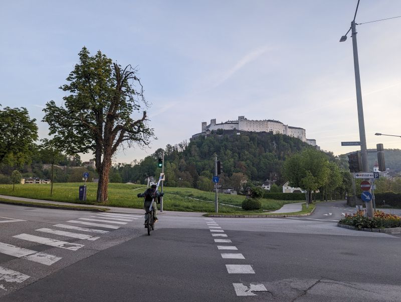
Not the most common thing to bike with the skis in front of Salzburg fortress.
From Freilassing to Berchtesgaden it takes about 45 minutes, and for two people the Bayern-Ticket is well worth it, 39 euros and you can use all regional trains in Bavaria. From Freilassing to Berchtesgaden you don't need a special bike ticket, the district covers it, otherwise and if you're going from Salzburg the 1-day bike ticket for all regional trains is €6.5. Both tickets are easy to buy from ticket machines.
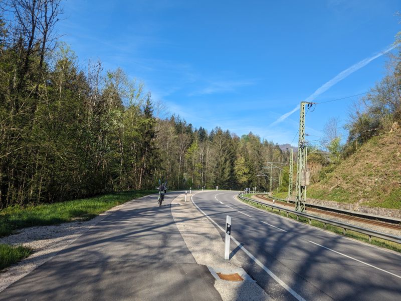
First there is a bike lane next to the road, later just along the road or changing already to the other riverside to have some smaller roads. We followed the road to Engedey.
Berchtesgaden - Hammerstiel car park - Benzinkurve - Kühroint
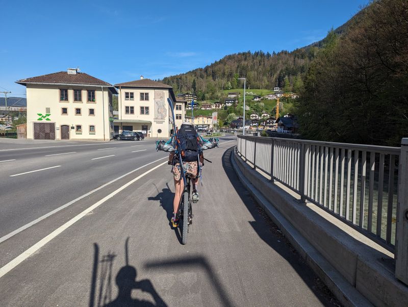
As you leave the station, there is a cycle sign to Ramsau to the right. At the beginning there is a cycle lane and afterwards just along the road, but there was not too much traffic. At Engedey there is a bridge towards Duftberg, here turn left and cross the bridge. Follow the gps/signs to Hammerstiel car park, but follow the car road and not Google Maps for bikes, as it's a tricky forest road and not really suitable for bikes.
If you're arriving by car with the bikes, the Hammerstiel car park is also the place to go, and from here there's a mountain bike track along a forest track that climbs higher and higher. Sometimes it's quite steep. The easiest way to transport your skis is to lock your boots into the bindings and carry them both on your rucksack, perhaps tying them together at the top to make it easier.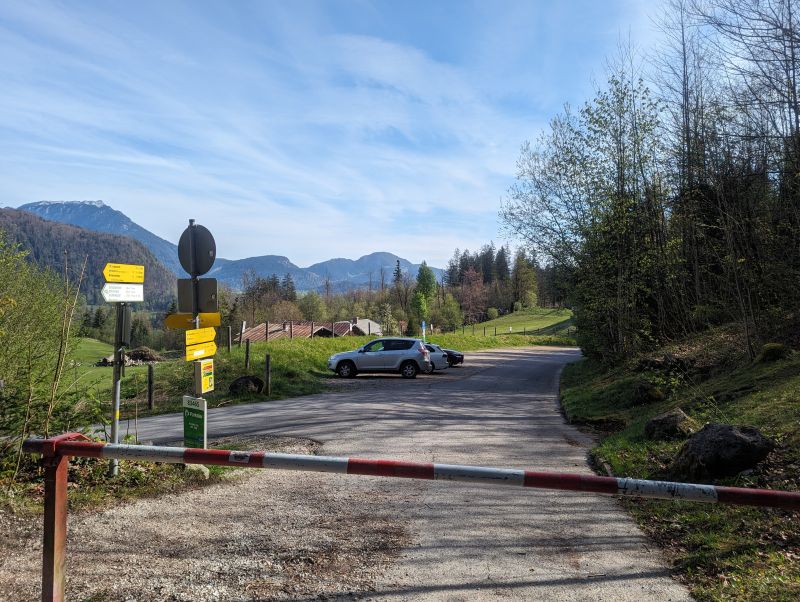
Parking lot Hammerstiel. For car arrival, just parking here and then onwards on the bike.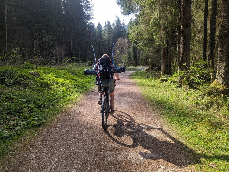

Already as a bike trip this is recommendable, Watzmann is appearing more and more.
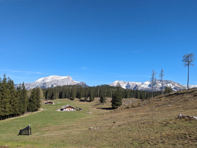
Depending on snow conditions, you can start at the Benzinkurve (a hairpin bend to the left with a bench and something to lock the bike) and carry your skis from there or, especially later in the season, continue on to Kühroint. It's another 150m higher and gives a shorter access to the snow.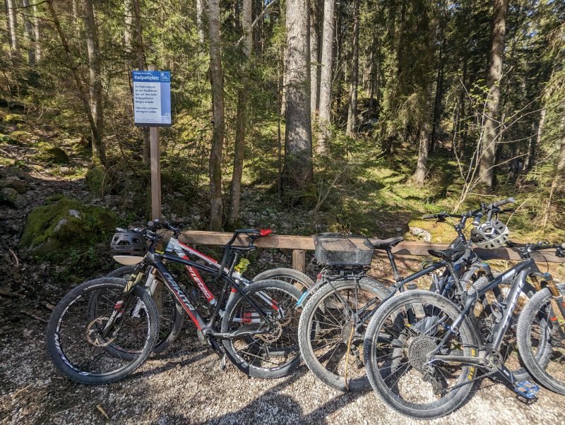
Up: the bike park at Benzinkurve. If there is enough snow, a stark from here works, otherwise better biking onwards to Kühroint.
Bottom: the small church at Kühroint, the path in the middle leads to the cvm, which lies just hidden between the two mountains in the center.

Around 20 people had the same idea as us, just before the hiking path gets more narrow again, the bikes were parked, mainly e-bikes but not only.
Kühroint - Watzmannkar - Return
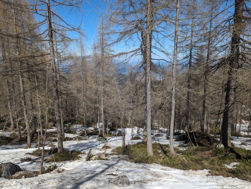
At Kühroint there's a place to lock up the bikes and follow the path number 442 towards the couloir until there's enough snow to switch to skis.
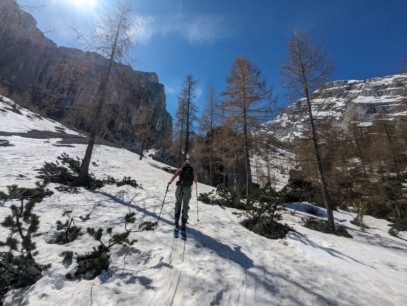
We left the light shoes behind and started the ascent at around 1600m. The snow was still quite good and there was constant snow cover for ascent and descent. 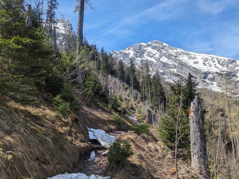
Up: hiking path towards the Kar and the snow. Bottom: as soon as there is enough snow cover you can change to the skis and start going uphill.
Once the cwm opens and you can see the end, you will also see the two options, probably already with traces. Either keeping to the right of the rock seperating the cwm to the 5. Watzmannkind and a saddle or keeping to the left to the 3. Watzmannkind. We kept to the left as there was less sun, more shadow and we hoped for better snow conditions.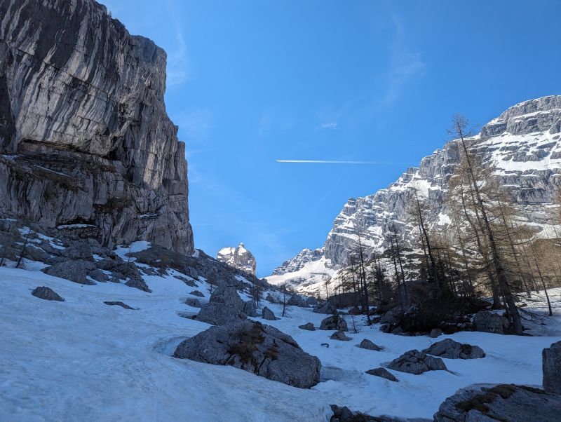

To the center left is 3. Watzmannkind. The closer you get to the dark rock in the middle, the better you will see the traces of the other people. We aimed for the left part because there was less sun as you can see on the shadow just next to the rocks.
All endpoints are around 2200m, we turned around at 2050m due to the late day (takes a bit longer with normal bikes all the way from Berchtesgaden). Below you can also see one avalanche which must have came down the days before, with keeping to the left it should be safe, less sun and no direct danger with snow slides coming from the mountain.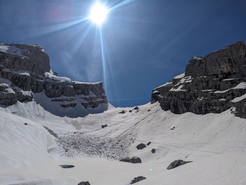
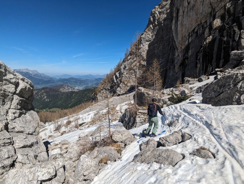
And finally the descent starts, with it being already being 2pm it was already a bit late, but the snow cover was still very stable, and we had some fun going down. In the valley it was around 25 degrees, it seems that due to the northern orientation the snow maintains very well throughout the day. 
Back down at Kühroint, one alp had already some soft opening with drinks and a small menu, which was highly appreciated!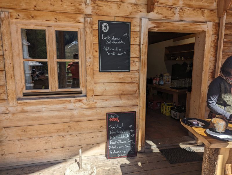
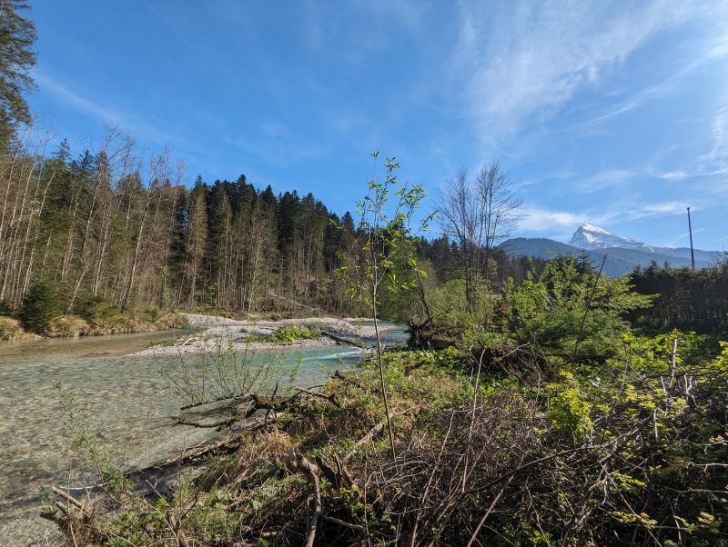
Up: On the way back there are several opportunities to cool off in the river. The descent is better over the Wimbachbrücke. The descent is better than to Hammerstiel by mountain bike, a bit longer but better. There is a clear sign there the roads separate.
Down: Finally back at the train station!