Austria has quite many mountain passes and several are suitable for bikes, the most famous one via the Großglockner high alpine road. With the train it's possible to access it quite well and from a day trip to anything longer everything is possible. A overview over some options will follow, always difficult to say how suitable it is for someone else, depending on fitness, bike, and weather/wind conditions. Enough vertical meters will be definitely always included. Pictures from July 2022.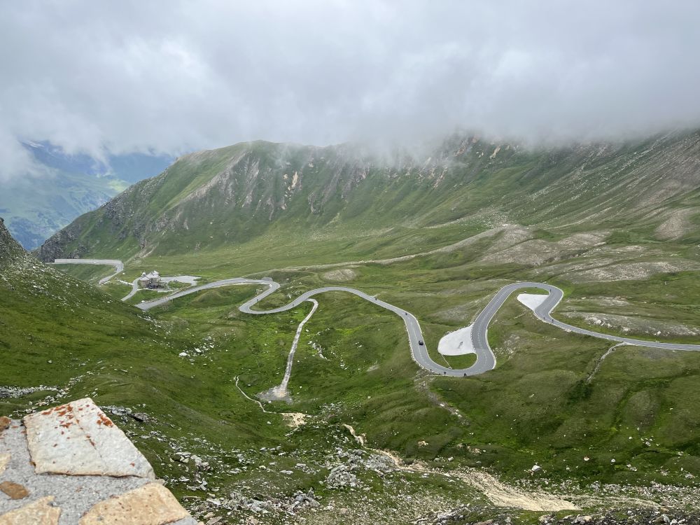
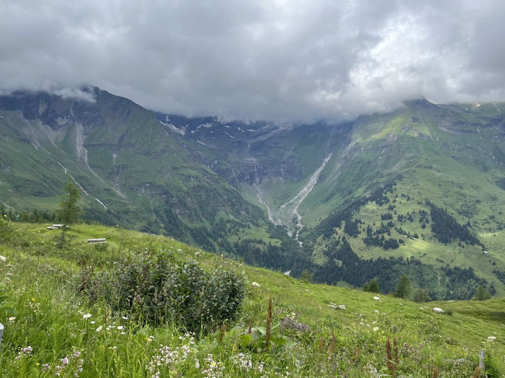
From Fuscher Törl the view to the side of Salzburg.
Transport
Via Salzburg (leaving in Linz or Vienna in the early morning) we took the train to Bruck-Fusch Bahnhof. Fastest connection from Vienna is 4:18h and leaves 5:20 or 6:20. Trains back from Bruck to Vienna till around 8pm for an extensive day trip. Keep in mind that reservation for long distance trains with bikes is obligatory. 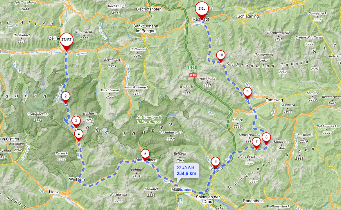
Source mapy.cz and better view: From station Bruck-Fusch (start), to Fuscher Törl (2, option to Edelweißspitze), at crossroad (3) decision between down to Heiligenblut or biking higher up with a better view, in Obervellach (5) the dropout option and going up to Mallnitz for the train. Spittal another long distance train station, our overnight stay was in Gmünd (6). In Innerkrems (7) the crossroad for Nockalmstraße, but we just went for Schönfeldsattel. Via Mauterndorf (9) to Obertauern (10) and back to Radstadt (Ziel).
Biking
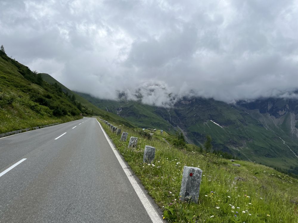
From Bruck the train is always well signed, following to Ferleiten (toll station) or Fuscher Törl (mountain pass). Till Ferleiten there are mainly bike paths next to the road, very soon a bit of ascent starts. It is recommended to bike up before 9am or after 3pm to have less traffic, with public transportation of course not really possible, the weather was not too good on our day, so the amount of cars was also not too much.
For bikes the usage of the toll road is for free, and it starts from Ferleiten, always uphill, several serpentines and constant incline of around 10% the whole time. It took me around 2h from Ferleiten to the crossroad to Edelweißspitze.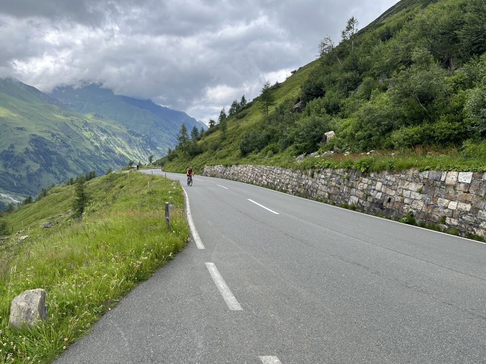
View from Fuscher Törl, in the back and in the fog, there is the Edelweißspitze. Pictures above all from the ascent between toll station and Fuscher Törl, unfortunately limited view.
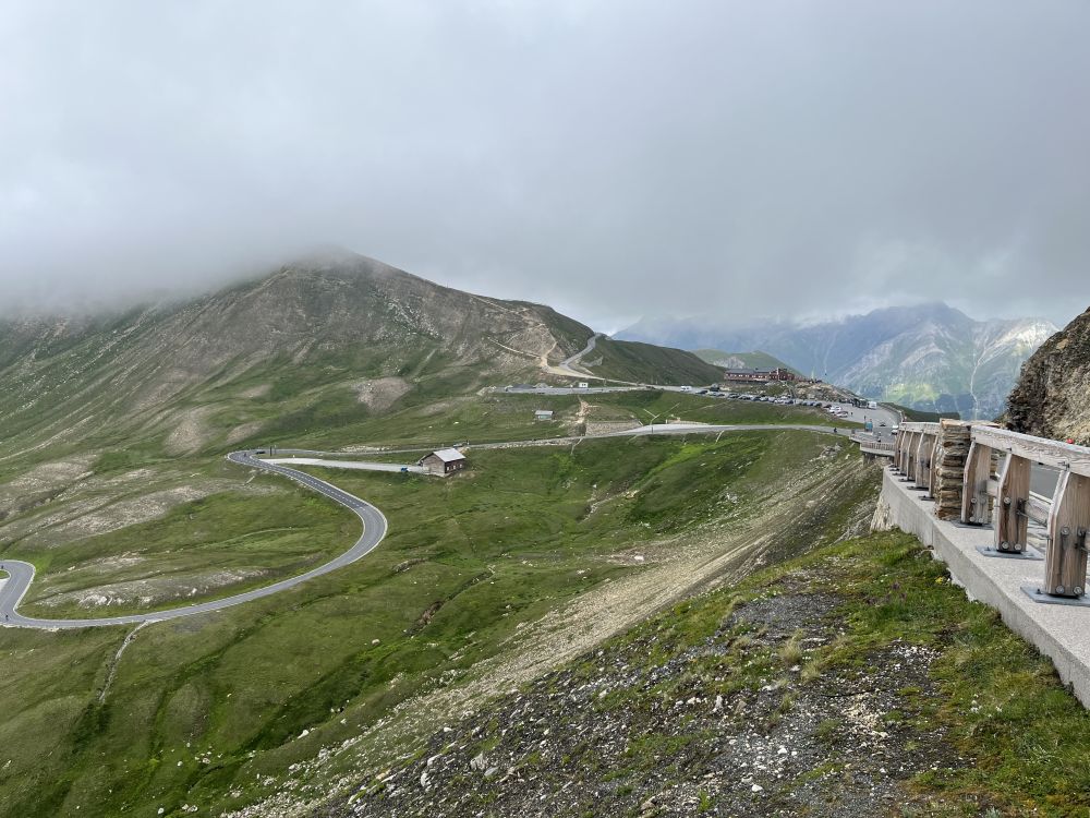
Here you have to decide if you go the last meters via cobblestone up, especially when descending the same path it's recommendable, or just skipping it. Due to bad weather this was our decision, and we continued to the Fuscher Törl, the first mountain pass of the day. Straight afterwards around 300 m of descent start just to go up approximately the same difference to the Hochtor, the highest point of the tour and the border between Salzburg and Kärnten. 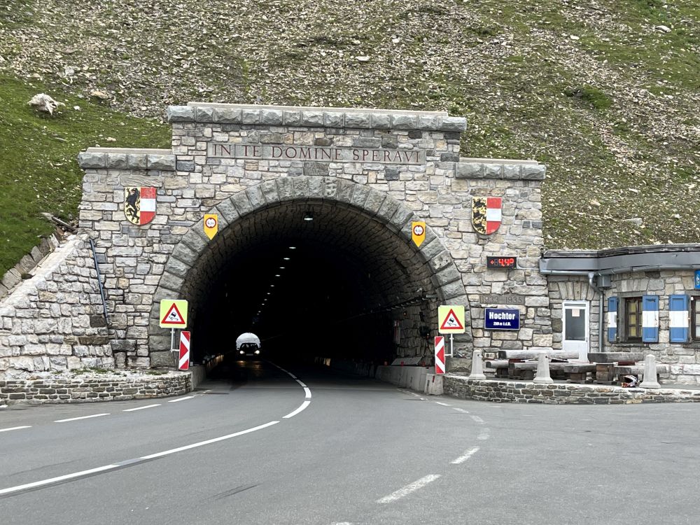
For returning to Bruck the same day, Edelweißspitze is the best choice, but the nicer view in my opinion is when descending the other side to Heiligenblut. The glaciers of Großglockner become visible. The black pyramide in the back is the main summit and highest Austrian peak.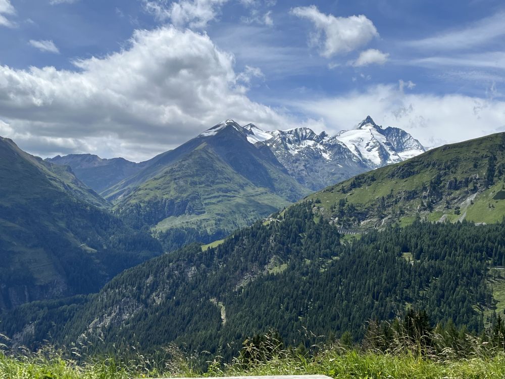
Großglockner in the back.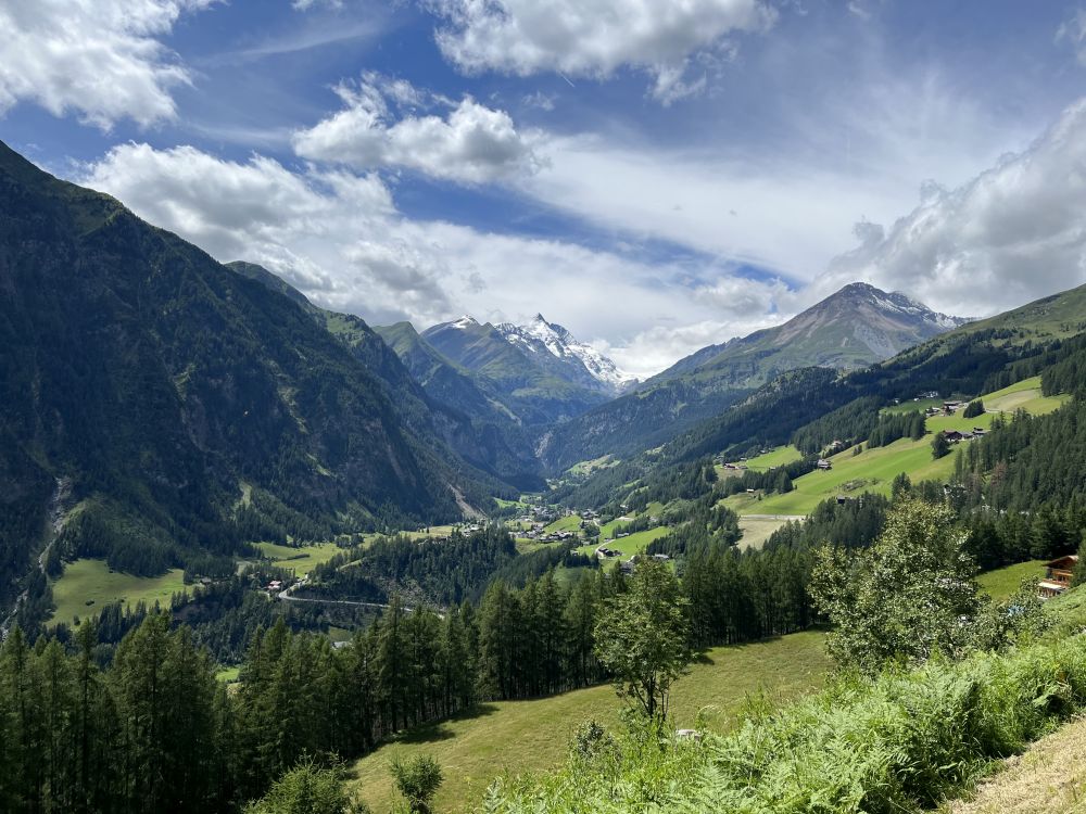
When biking down there's the option of Franz Josef Höhe, with a view to Austrian largest glacier, the Pasterze, due to the length and more ascent we skipped it and continued via the toll station along the road. Depending on where you want to sleep, you can bike down straight to Heiligenblut, we stayed up a bit higher on the hill, skipped the village and continued via Apriach to Döllach. Restaurants just opened at 4pm again, so a supermarket served us our lunch and saved us time. We were still unsure about the destination, just knew that we want to get as far as possible out of the Mölltal towards Spittal an der Drau. From Heiligenblut it is around 80 km. In Mölltal there is a biking path, mainly we used this but when it seemed more of a detour and unnecessary vertical metres, we just went for the main road.
One option for a great round-trip is to bike up from Obervellach to Mallnitz and take the railjet there back to Salzburg (most probably a two days trip) or biking to Spittal and taking the train from this city.
We had still plans for the next day and wanted to return from Radstadt, at least two mountain passes were still ahead of us, about the exact route we just decided at dinner. Therefore, our hotel choice was in Gmünd. Till there we covered 140 km and 2600 m uphill.
Gmünd itself is already worth a visit, nice main square with a castle hosting several restaurants. Thanks to its location, it first served as a stronghold to protect Salzburg against invasions from Kärnten and was later an important merchants' place on the way to Italy.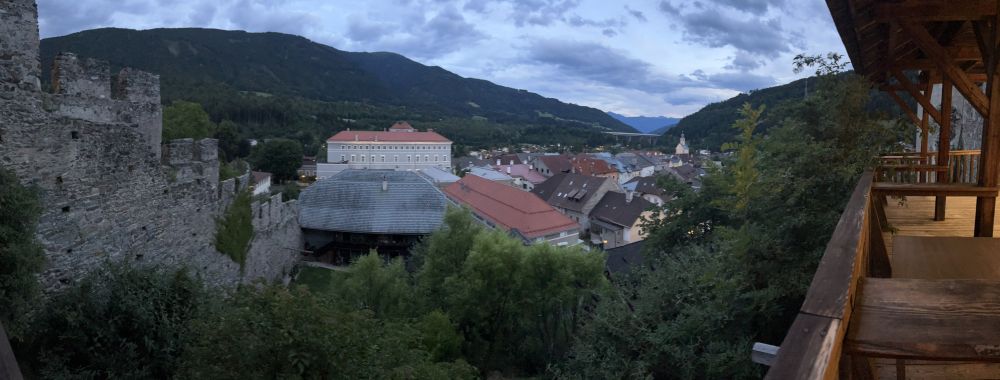
View from Gmünd castle.
The original plan was to go via Innerkrems the whole Nockalmstraße, another high alpine touristic toll road. Via Turracher Höhe and Obertauern Pass it would have been back to Radstadt, unfortunately 3300 m uphill were just too much for one day. If you have one extra day it's a great option, sleeping around Ebene-Reichenau or Turracher Höhe and next day returning to Radstadt.
We chose between Katschberg and Schönfeld Sattel, the latter has way less traffic, fewer hotels and seemed more tempting for us. From Gmünd in the morning immediately uphill first to Innerkrems (here the crossroad to Nockalmstraße leaves) and then continued the Schönfeld Sattel, close to a 1000 m up for a start into the day. Around the saddle great (for us cloudy and rainy) landscape. Afterwards, the road just goes down all the way to Lungau in Salzburg.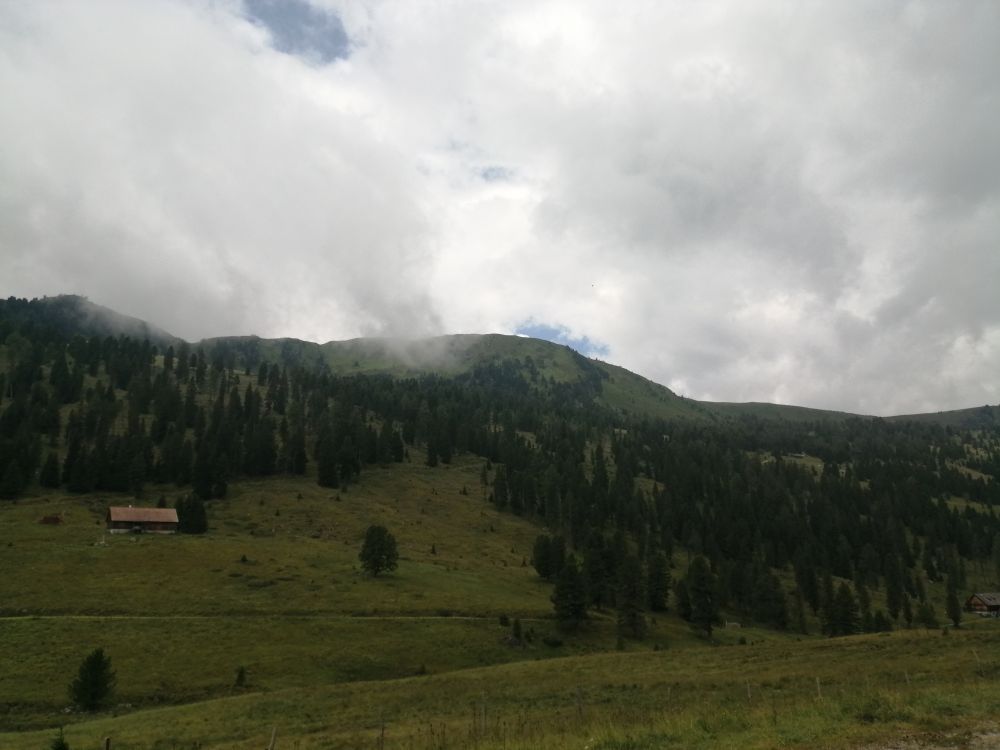
View around Schönfeld Sattel, in real life it looked more impressive.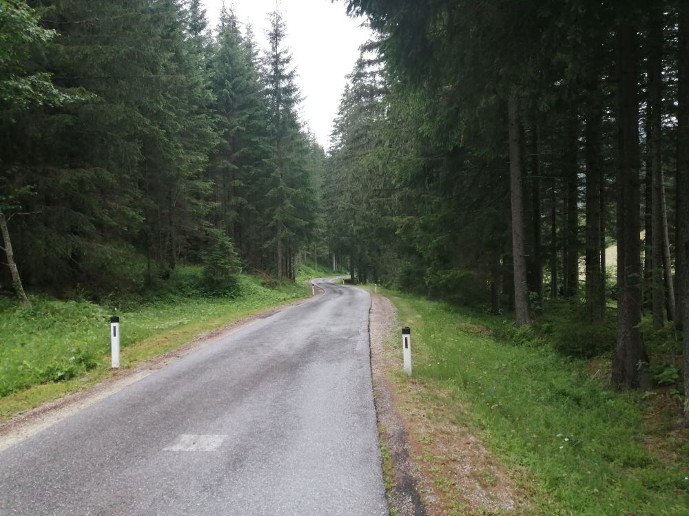
Perfect road conditions to descent with 50 km/h and more!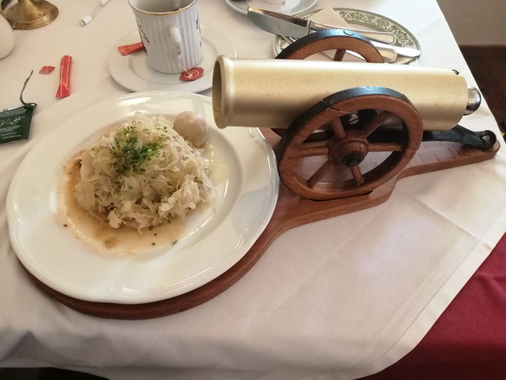
The Lungauer dumpling surprise was indeed a surprise as the dumplings were rolling out of a cannon.
In Mauterndorf we stopped for lunch, due to the rain one consideration was taking the bus to Radstadt, leaving every 2h, but motivation still existed and rain got less, therefore we went for the last pass road of the day. Via Tweng up to the skiing resort town of Obertauern, in total 18 km. Definitely from the 3 passes the most unpleasant due to heavy traffic and hardly bike lanes. The town itself far away from looking any kind of nice, but that's the usual problem with the artificial skiing ressorts. Down to Radstadt it is around 24 km and around a well maintained road, so was absolutely fun, a moist road made us in the curves go a bit more cautious.
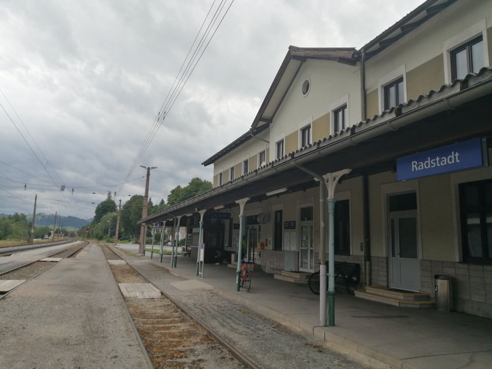
In Radstadt you can bike straight to the train station. If there's time to spare before departure, you can check the old town, worth a visit with many restaurants. Alternatively biking on a biking path the 5 km to Altenmarkt (this is certainly just to kill time, when returning there is a cool view to Dachstein though).
At 18:26 our direct train to Salzburg left, I changed to a Railjet to Vienna. Around 10pm it arrives in Vienna, plenty of time on the second day for several pass roads.