Between Bad Ischl, famous for being the summer residence of the Austro-Hungarian emperor, and Hallstatt, famous because cute, there lies a long mountain, Kalmberg. To me it was unknown, but from passing on the street it looked quite impressive. I asked around and for locals it's not unknown at all. It turned out to be one of the nicest tours, very divers, some scrambling with views all the way to Großglockner and Großvenediger. My hike took place in Oct. 2022.

Source: mapy.cz. I got picked up from the train station of Bad Goisern (Ziel) and we started at the parking lot (6). For all train this is the best option, for car just parking lot around point 6. Important to go from Niederer Kalmberg to Hoher Kalmberg (in order of that picture) to have the climbing parts during ascending and not descending.
Transportation
By train to the station of Steeg-Gosau, return from station Bad Goisern. Twice Bad Goisern is also possible, distance is similar, but like shown on the map you see more different paths. The connection from Linz is very decent, fastest connection 1:40 and leaves approximately every hour, also on the way back.
For arrival by car the parking lots are around point 6 on the map, there are several around there, all for free and marked with blue P signs.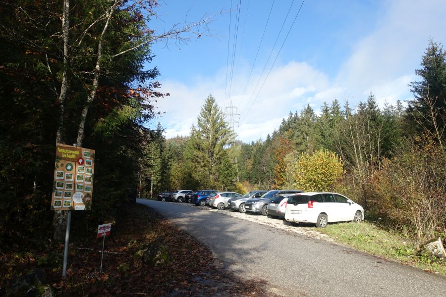
Hike
For an easy, though less exciting, hike, it is possible to walk straight to the Goiserer Hütte and from there the easier path to the summit of Hoher Kalmberg. Back and forth it is also shown with 5-6h, although it should be for the majority way faster.
Our hike turned just after the parking lot on the first cross-road to the left, just following the sign to Kalmberg via the Tiefe Scharte (low saddle), whole path is estimated with around 8h, it took us without running around 5,5h in a steady pace.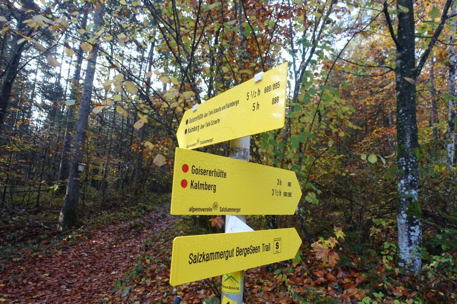

The first part just follows through the forest, especially in autumn of course very nice colours, maybe bit slippery, but till the Tiefe Scharte no big obstacles.

The only kind of more tricky part, secured as well with an iron rope, crossing some loose rocks, but no big issue.
The Tiefe Scharte, no view yet to the south, also still covered with trees, but used it for our first break and some food.
The first peak with the bushes is the Niederer Kalmberg, the one behind the Hoher Kalmberg and on the lower part to the very right the Goiserer Hütte. This means that after the saddle and after each peak it is a bit ascending and descending again.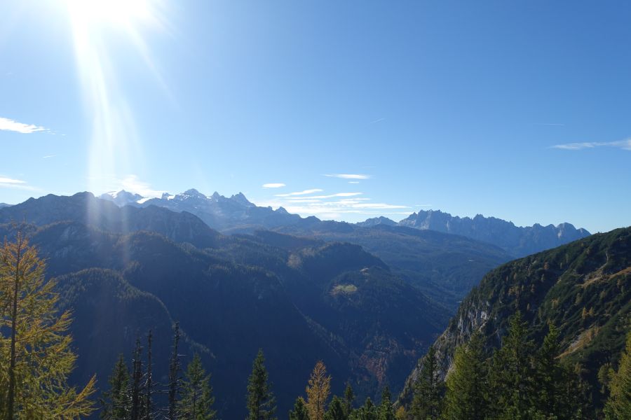
This stunning view will accompany you for the next 2h, to the left there is the Dachstein with its melting glacier and to the right the Gosaukamm (both great mountains with many tours, for example the Gosaukamm circuit).
Short climbing parts like this exist several throughout the tour. Never high, never difficult, but hands and some active body movement definitely needed, to my opinion it was never exposed. 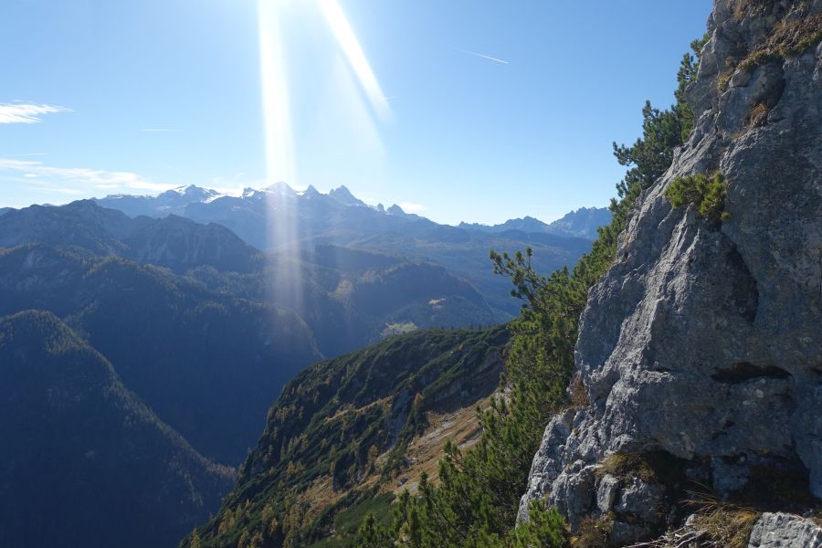

Between the green mountain pines, the path is recognizable, from the saddle always on the south side of the mountain.
Summit of Niederer Kalmberg, the valley to the left is the Gosautal, the wooded hills host the skiing area Dachstein West. In the very back the snowy peaks are the Hohe Tauern, Großgockner, Großvenediger, the highest peaks of Austria. To be it came quite surprising, I did not expect such a view because usually Dachstein is blocking the view.
Skiing resort in the forests, the end of Gosaukamm to the left and in the back the Hohen Tauern. Tauern just means passes, so literally translated the name just means high passes.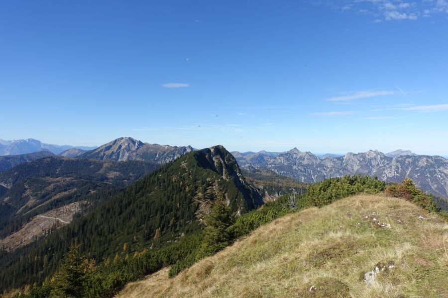
View from Niederer Kalmberg to Hoher, bit down, bit up, story of the day.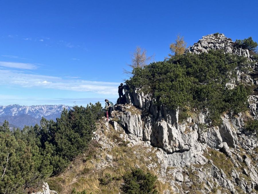

One of the reasons, why I loved the hike was, that till the summit cross of Hoher Kalmberg we were more or less alone, met a handful people. Then, when reaching the cross, it´s goodbye peace and a "Grüß Gott Berg" (because you greet so many people). The view, the hut and the easier hike from the other side are good reasons for it being popular.

For us the side of descent, for the majority the ascent, far away from any difficulty, as I said, more fun and more quiet is the scrambling part from the other side and traversing the whole mountain. The rock face here reminded someone of an native American, so now it is called "Kalmberg Indianer".
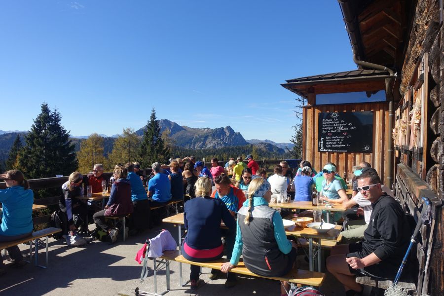
Popular hut, for good reasons! In the end despite looking packed, everyone got a seat in the sun.

My choice was the (probably vegan) chickpeas-beans stew and a nice piece of a raspberry cake. Deer ragout also looked great and Kaspressknödel were also one of the better ones I had this year.

From the hut it is marked with 2,5h back down, we needed half the time till the parking lot. An interesting sight around the Goiserer Hütte is the Kalmooskirche, a cave, which served protestants as a church, when they were religiously prosecuted. This happened till 1781 when emperor Joseph II issued the Patent of Toleration and with it extending the religious freedom.
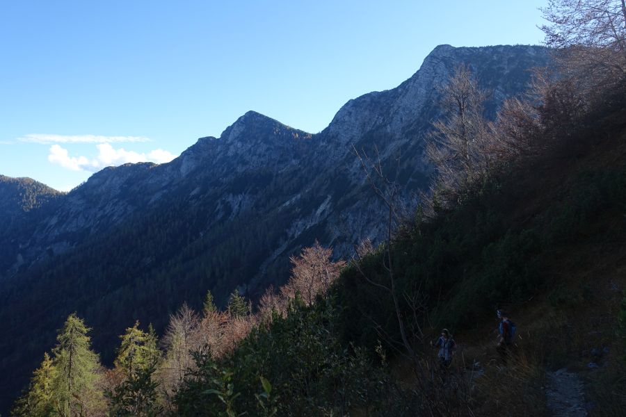
The Niederer Sattel is the lowest point/saddle on the mountain range, through the forest, we reached it. The path followed the ridge, in the middle Niederer Kalmberg and to the right the summit of the Hoher Kalmberg.