After going in 2022 via the Weichtalklamm and the Schneeberg plateau to Puchberg, I tried it this year the other way around. Several ridges are on the northern side of the mountain, and as it was by train, it seemed perfect to descend on the southern side via the gorge. Around 20 km and 1600 m up and down with numerous parts of easier scrambling.

Source and editable version. From Puchberg via normal roads back to the foot of Schneeberg. From there several options up, we went for Novembergrat, Klosterwappen is the highest point, from there (or via a more direct path there is the option of a break in Fischerhütte)). Just a 5 min walk from the Weichtalhaus, there is the bus station for the way back to Vienna.
Transportation
With the train from Vienna to Puchberg/Schneeberg, usually with a change in Wiener Neustadt. From Puchberg train station, it's around half an hour to 45 minutes along small roads to the real beginning of the hike. We left Vienna at 6:58 and scheduled arrival was at 8:24.
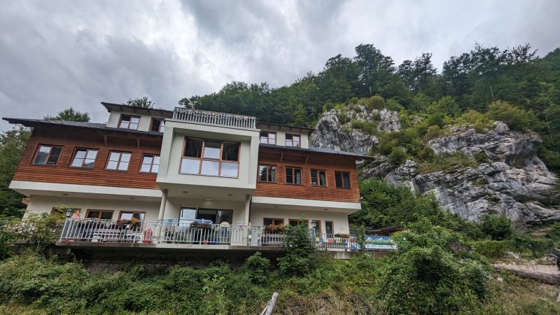
The departure was by bus from Höllental/Weichtalklamm. On Sundays, buses run every 90 minutes, but just next to the bus stop, there is the great mountain hut Weichtalhaus with amazing food to kill any possible waiting time. Buses back around every 90 min. We caugt the 17:02 one, at Payerbach-Reichenau one changes back to the train to Vienna.
Train station of Puchberg, free toilets and just along the tracks to the back of the valley next to the Salamander-Bahn the hike starts.
Hike
From the station, we followed the roads towards the farm Schwabenhof for around 40 minutes. It's pretty obvious with clear weather because it's just along the northern slopes of Schneeberg. From there, we took the Schneidergraben uphill.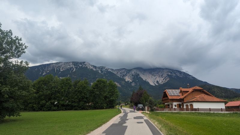 View back to Schneeberg, the cloud to the right covered the peak the whole day and lead to very nasty weather next to the summit cross.
 After leaving the roads, a forest path starts straight away with obvious signs.
It's very rocky and not too pleasant to walk. I would rather recommend the Lower/Unterer Herminensteig, which is first a forest road and then involves easy scrambling uphill with one rope-secured part, which you can walk around as well. Halfway up, all these ascents are connected via Nördlicher Grafensteig, and whichever option you chose until now, it's now time to decide which path to take uphill.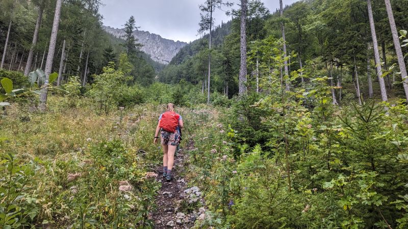 Top: rocky road to Grafensteig. Bottom: Schneidergraben hits the Grafensteig path and we turned to the right for the Novembergrat.
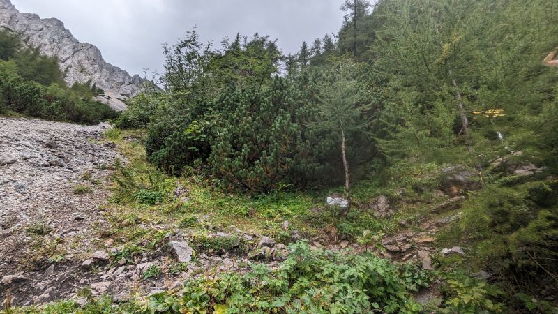 We went for the Novembergrat. Following the path to the west, there's a viewpoint, and here the path leaves the marked trail and goes uphill a bit through the forest. Pretty soon, hands are needed, and walking and scrambling follow each other. The path and the surroundings become rockier, and the view of several stone structures is just great. The path is easier than expected, probably the same difficulty as the Oberer Herminensteig, maximum grade I, and always easy to find with red and blue markers.
 The marked trail leaves further to the right/West. An unmarked, but very visible path leads through the forest to the ridge. Just opposite the crossroad, there is a view point for orientation.
 The landscape gets much better, rocks all over and walking parts and scrambling parts are following each other. The ridge never gets difficult and is not really exposed, really pleasurous also with not perfect weather.
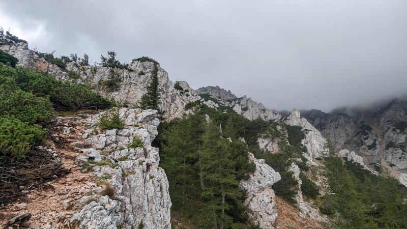


 Top: view back down to Puchberg. Bottom: final climbing and reaching the plateau of Schneeberg.
 Once reaching the plateau, there's the question of how and where to continue. For descending on the same side, there's the rewarding Herminensteig, Nandlgrat (never been but should be similar difficulty-wise), or just along the train tracks or with the train. If you're already using public transportation, the most varied and appealing option is via the Weichtalklamm, a gorge to the northern side. On the way there, you pass the highest point of Lower Austria, the Klosterwappen, which is 2076 meters high. Fischerhütte is just next to it. When we've been there, it was all full, and we just descended and ate at the end. If you have enough snacks, the Weichtalhaus offers better food in my opinion. Views on the plateau were non-existent; strong wind with rain did not make it too pleasant. From Klosterwappen, several paths lead onwards. With all the fog, we took the wrong one first but soon figured out the correct one.
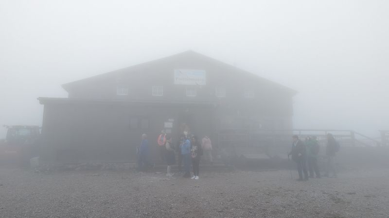 Top: Fischerhütte in the fog. Bottom: Klosterwappen summit cross.
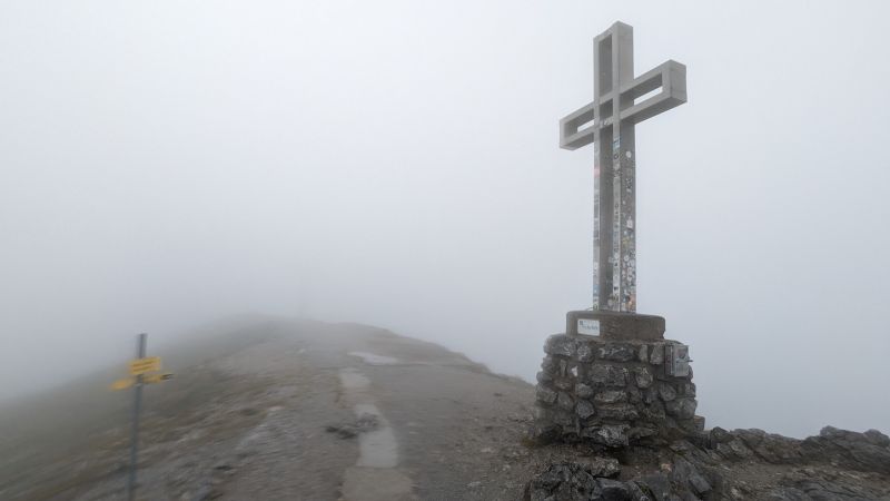 Going down is very pleasant, via open meadows, with theoretical views of Rax, and later through a forest. The beginning was extremely unpleasant, cold wind and rain blowing towards our faces, but soon we left the cloud and weather and landscape got better.
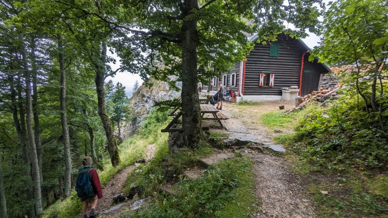 Kienthalerhütte, it is located at the upper end of the Weichtalklamm, from there it is only a couple of minutes to the start of the hike down into the gorge. There is the option also to continue just via a normal hiking path and skipping the gorge, but that would be a waste of views. Information sign says, that a helmet is recommended: I do not see a reason for this. Some ladders and iron ropes are helping on the way down, overall not difficult and just a great path.

 After leaving the gorge, there is the Weichtalhütte, as well a centre for kayaking, very nice chef and really delicious spinach dumplings and mushroom goulash. From the hut just via the parking lot to the main road, there to the right, the bus station is already visible.