
For a longer holiday in autumn 2023 I opted for 3 weeks of mountaineering and trekking in Nepal. Some of my thoughts for the decision and some conclusions and pictures.
Travel period
October/November is from a central European climate perspective perfect, weather, and days are getting worse, whereas in Nepal there is one of the main travel times. It's colder on autumn than in April/May season but the sky is clearer and the views are further.
Region/organization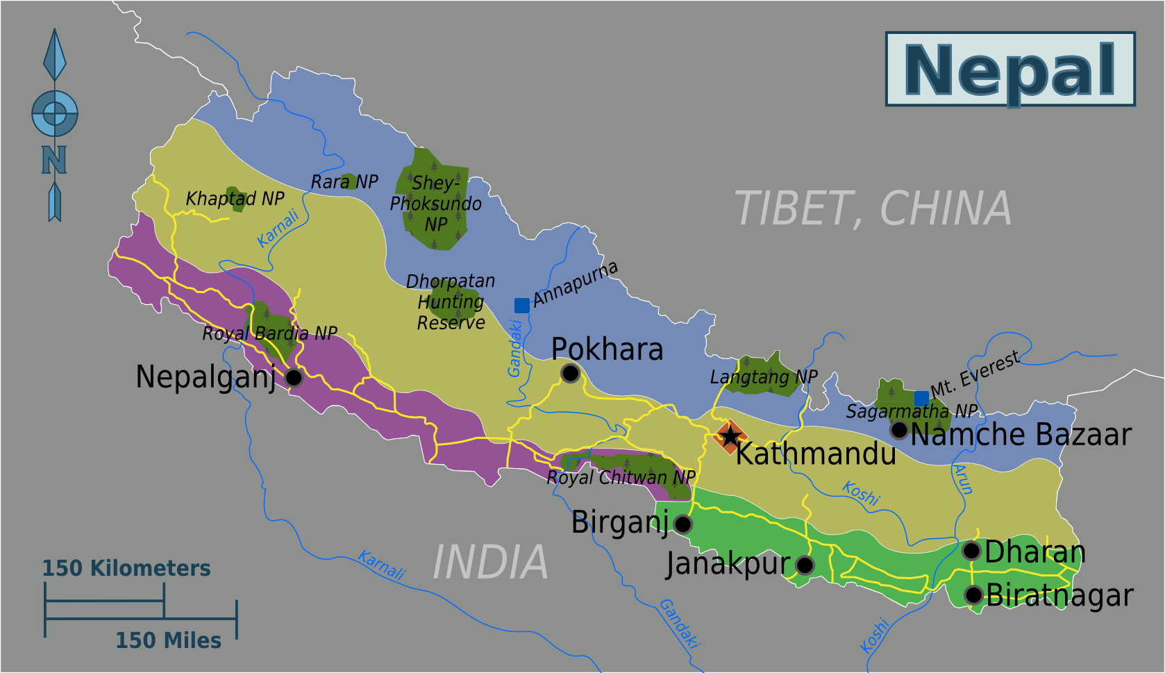
Source
After deciding about travel time and destination, the difficult question was, where to go and how to organize it:
For me, it was clear that I wanted to have 6000ers also as part of my trekking, therefore it's difficult to avoid to at least book part of the trip via an agency. Only trekking (Annapurna circuit, Everest base camp trek) is also doable without a porter and a guide (despite media reports, it seems that there are still no checks. Especially Khumbu/Everest Region denied the obligation for a guide, the highway back to EBC definitely does not need one). A friend in his 30s said that he is certainly too young and fit for only trekking, I would also go along with this. The long way to Nepal, 3 weeks of time, there is the motivation for more.
So then choosing the right region:
I was consulting with people who made several Nepal trips already, and they advised the Everest/Khumbu region, highest mountains, most spectacular views, having Everest, Ama Dablam and so on seems to be the most spectacular thing. Also, not a secret hint, obviously.
Mustang is culture wise more interesting, closest to Tibet without coming to Tibet, but the landscape is more dry (lying to the Northern side of the Himalayas) and less icy peaks.
Annapurna circuit is mainly a forest road, views still good.
Manaslu circuit also seems to be nice, easy trekking as well but fewer people than around Annapurna and some of the nicest located villages in Nepal.
Rolwaling Himal is also popular in Everest region, you walk a West east valley for pretty long until you get higher and higher and views better and better till crossing a pass towards Everest. One of the group did this, said it was spectacular, but our chosen route even better and more divers.
With talking to our people the 3-valley tour in Everest region seems for the next time the most appealing to me: 3 passes with over 5000m, everything in lodges, therefore easy to organize also without a group, for a couple one guide and one porter is enough, if not even possible to attempt it alone as well. It involves crossing a glacier for 1-2h, so no sure if it's also doable without a guide, I suppose yes.
So the region with Khumbu was settled, then the question which route to select. I was looking at different agencies and found a trekking route involving 2 6000ers and a close to 6000m pass: Mera with close to 6500, Island peak with over 6100 and Amphu Lapsa with 5800 something. Several nights were spent in a tent, and it was a bit off the main tourist paths, which seemed very appealing to me. We talked on the way to numerous people, prices of other routes etc and for a first time adventure trek with 6000ers and lone valleys, this tour seems to prove the perfect choice!
Various local outfitters offer it with a shorter route via the 4500m high Zatwa La on the second day, from a European flatland standard this seemed to be too risky. It can work but if one catches some high altitude sickness it's unsure how fast one recovers, the people we met doing this alternative managed it but suffered quite a bit. Difficult to say as it depends on a every day fitness evaluation but safer is definitely the longer approach via the south and with more days around 3000m. Thus landscape wise it's very interesting, a kind of a rain forest.
My route
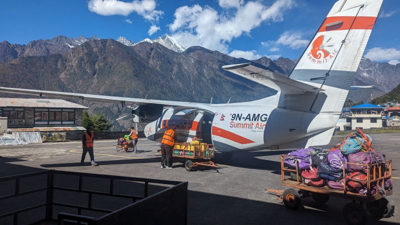
The advantages of travelling with an agency appeared right in the beginning, the weather in Lukla was bad for numerous days and there were hardly any flights in or out. Also, on our travel day there were not too many flights leaving and just with the jam from the previous days it was packed. Luckily our tour did not necessarily need to start in Lukla but from Phaphlu, another small airport in the region, it is possible to start as well. The flight to Lukla is due to clouds and fog always tricky. The pilot is just flying and navigating on sight and there is a pass with 3000m to cross. If there are clouds it is difficult to see where the mountain starts and one should be happy for not flying under such conditions.
From Phaphlu it is then a 7h jeep ride to Kharikola to connect with the original plan south of Lukla.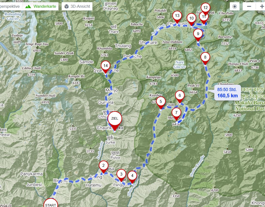
Source: mapy.cz.
Day to day schedule:
0. Flight to Phaphlu (start, 2400m altitude), jeep drive to Kharikola (#2 on map, 2000 m)
1. Kharikhola to Panom (#3, located at 2900m): 800m up, 6 km, 4h
2. Pangom to Ramailo Danda (3200 m): 900m up, 500 down, 5h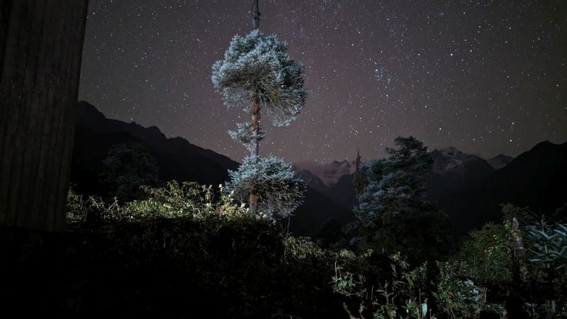
Clear sky, no light pollution, in the back the first sight of Mera.
3. Ramailo Danda to Dafe Lodge: 600m up, 800m down, 8 km, 5h
4. Dafe Lodge to Khote (3600 m high): 1050 m up, 550 m down, 9,5 km, 5,5h
5. Khote to Thangnag (#5, 4300 m) plus a bit extra acclimatization: 1000 up, 300 down, 13 km, 7,5h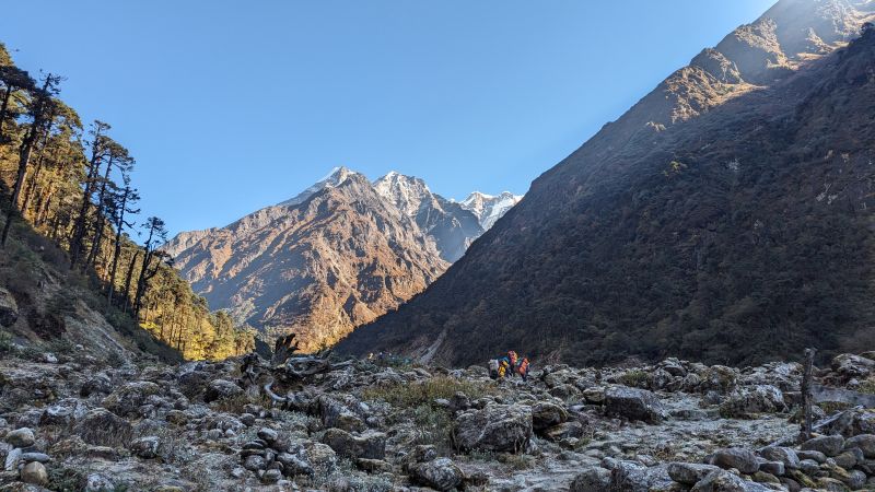
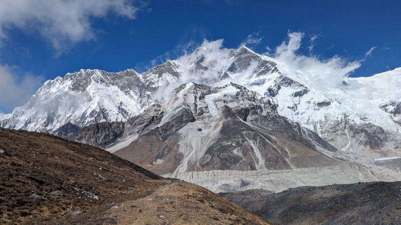
Following the valley more and more to the back and higher, the mountain in the middle is Mera, we followed the valley to the left and approached it from the back. Slightly easier than its South face.
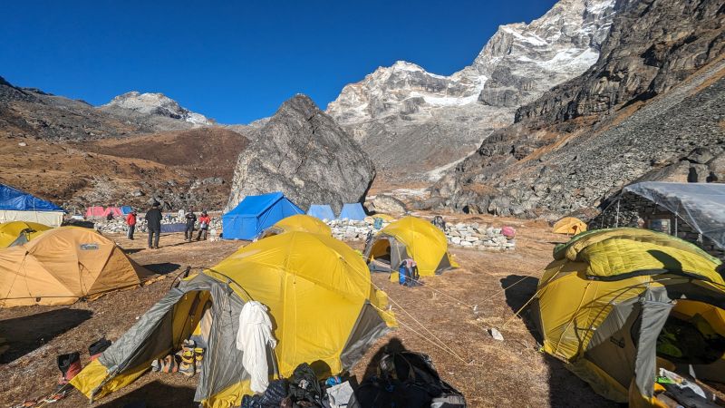
6. Thangnag to Khare (#6, 4900 m) plus more acclimatization: 1000 up, 400 down, 10 km, 7h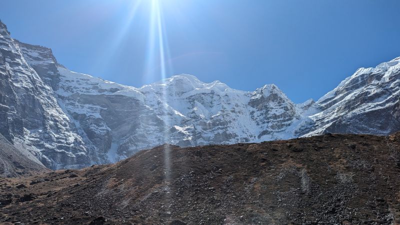
Lunch break point, a bit under Khare with Mera in the middle.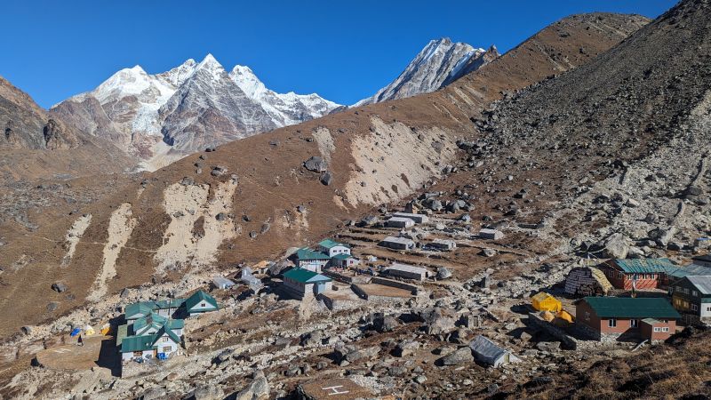
Village of Khare, the moraine in the back we used for our acclimatization trips. Great views in all directions!!
7. Rest day plus acclimatization around Khare: around 400m up and down on a moraine
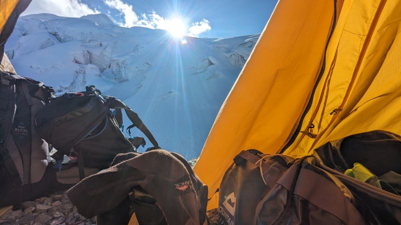
8. Khare to Mera High Camp (5800 m): 1000m up, 100 down, 6 km, 5h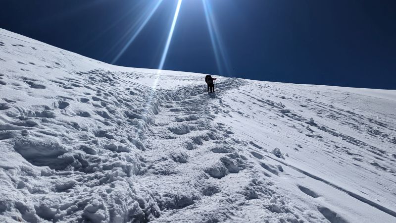
The way to the highcamp, flat easy glacier, no crevasses, no need for a rope but for crampons.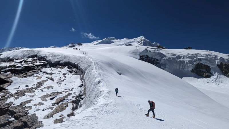
The highcamp is behind the upper black rock on the left top, the path to the summit to the left of the snow ridge to the small snow pyramid in the middle.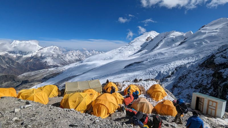
The highcamp, best toilet: inside it is icy, and you have the slight feeling to slip and slide into the abyss. The abyss is a stalagmite of brown and white layers growing to the top and at some point reaching into the toilet. 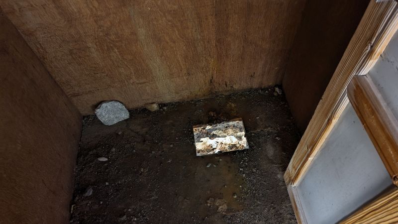
9. High Camp (5800 m) to Mera summit (#7, ~6400m) to Kongme Dingma (4800 m) in Hongu valley: 750m up, 1750m down, 12,5 km and 11h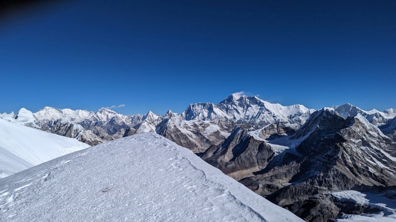
Panorama from the top of Mera, several 8000ers are visible: to the left Cho Oyu, the two pyramids in the middle are Pumori (l) and Ama Dablam (r). The mountain with the clouds is Mt. Everest, the dark ridge to the left Nuptse, the mountain just to the left is Lhotse with its 3400m south face. 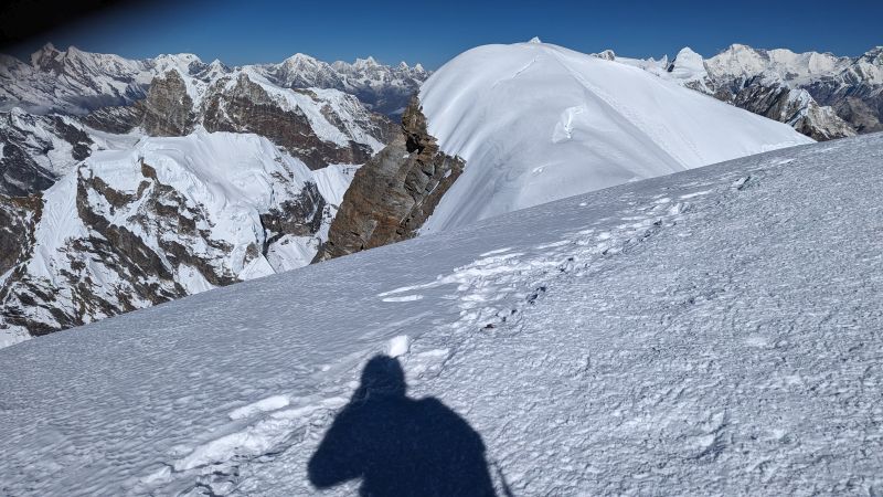
View to the North East: main (non ascended) summit of Mera and to the right again Cho Oyu. The left mountain on the longer mountain range to the right.
Finally descending, slightly easier and faster than going up. To the summit it took us 6h, descending worked in 2 h. From left to right: Chamlang (very right), Makalu, Baruntse, Lhotse, Everst (with the cloud again) and Nuptse. The right valley between the mountains in the middle and Chamlang we followed for the next days to get to the foot of Lhotse South face.
Kongme Dingma camp in Hongu valley.
10. Kongme Dingma back into Hongu for another campsite (5000 m): 10 km, 550m up, 250m down, 6h
Chamlang to the left.
Top: our campsite. Bottom: tent with views to the back to Everest and Lhotse. Mabye one of the nicest surprises when you realize that at the end of the valley you just see Lhotse/Everest. All of these camps were located around 5000m.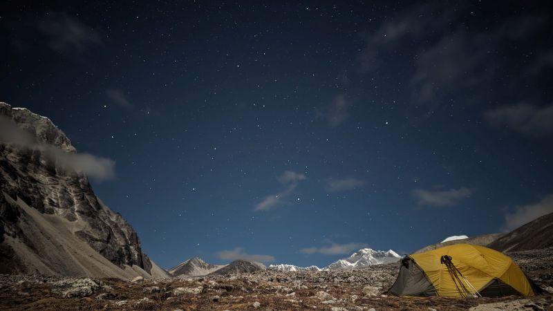
11. Camp site to Amphu Laptsa base camp (5500 m): 600m up, 150m down, 9 km, 6h 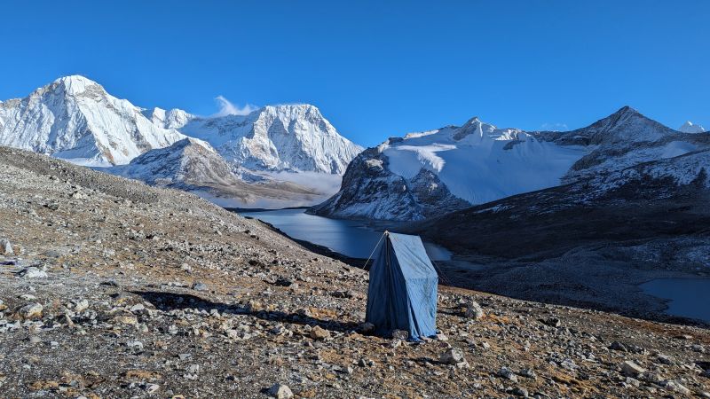
Top: toilet with a view (to Chamlang, middle, and Hongu, left). Bottom: sunset at the Chamlang wall. Two Czech alpininsts made an impressive first ascent just there, youtube documentary.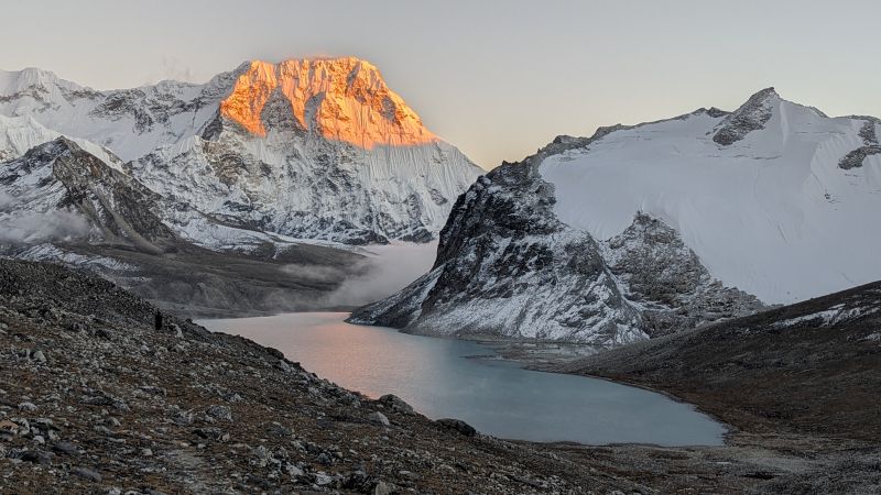
12. Amphu Laptsa base camp via Amphu Lapsa pass (#9, 5845 m) to Imja Glacier camp (#10, 5000m): 450m up, 1000m down, 9 km, 8h (rappelling from Amphu Lapsa with heavy luggage takes a lot of time with the porters)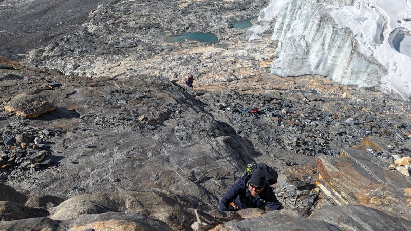
Top: technically Amphu Lapsa was the most difficult part together with Island peak, but this is mandatory for everyone to do. Going up involves some scrambling, often there are some ropes to support. Bottom: the view from Amphu Lapsa to Lhotse south face. The path leads to the left of the moraine around the mountain and then just head to head with the south face to the West for the next camp.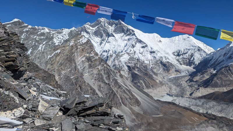
13. Imja glacier to Island peak BC (#11, 5100 m): 200m up, 3,5 km, 1,5h: short day to relax before the second demanding 6000er attempt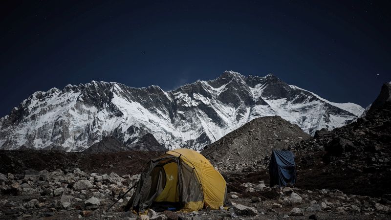
14. Island Peak BC to Island Peak (#12, 5165 m), back to BC and down to Chuknung (#13): 7h and 1100m from BC to Island peak, another 5h down. As I vomitted and turned around just after leaving at 3am just second hand information: quite some loose rock, challenging even with the fixed rope. 
Instead of climb on 6000ers I tried to recover and reading with a view to a 8000er is also not a every day thing to do. Without the sun two down jackets were needed.
15. Chuknung (#13, 4750 m) to Deboche (3700 m): 200m up, 1200m down, 15 km, 6h
16. Deboche to Namche Bazar (#14, 3500 m): 600m up, 900m down, 12 km, 5,5h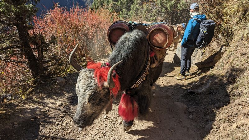
The whole Everest highway down is a kind of dirt road, many tourists and yaks are transporting also goods to the back. After 2 weeks in the solitude quite a difference.
17. Namche to Luka (#ziel, 2860 m): 19km, 700m up, 1300m down, 7h
Alternative routes: when you start from Lukla (#ziel) you just go south to connect approximately at #3 with our path. The alternative via Zatra La is from Lukla just immediately to the East to connect a bit before #5.
Accommondation
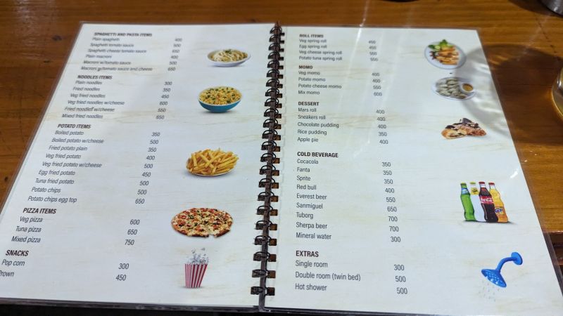
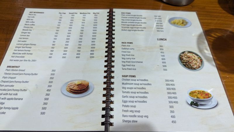
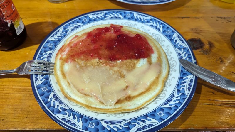
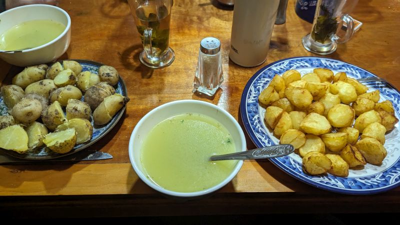
Most of the route we stayed in lodges, also if you want to travel alone without a guide, doable for example with the Annapura Circuit or Everest Base Camp trek, this is the way to go. If you sleep there it is usually even for free if you have dinner and breakfast as well (and how else you want to feed yourself), on the bottom one menu and the choices. Main dishes around 3-5 euros, pizza with a homemade soft dough, some (fried) rice and pasta, momos and different potato options. Everytime good and it is easy to have every evening something different to avoid 24h dal bhat power. For breakfast there is the choice between cereals, porridge, pancakes, fried dough. Especially breakfast I liked a lot, dinner was always okay but due to sicknesses plain potatoes or plain rice was too often the option to go for me. Typically, it comes along with big bottles of tea, 5 euros for 4l or so. The benches are after dinner then sometimes used by the porters to sleep there.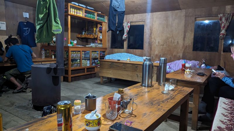
Most lodges we slept in had quite nice rooms, small, unheated, without electricity but clean. One thing to take along is definitely a warm sleeping bag, not always there were real windows, sometimes just a plastic cover did the job and when sleeping on 4000m it gets quite cold. I would recommend a sleeping bag with a comfort temperature of around minus 5. Mine was for -20, because it was also needed for high camps in the tent, but this was also still very nicely cosy in the huts and opening the sleeping bag is never a problem. I slept with my underwear, whereas several others already needed some layers for not feeling too cold.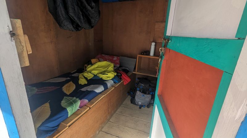
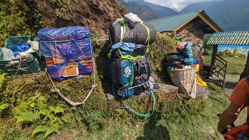
Impressive luggage of the porters, they carry up to 40 kg.
Kathmandu, stupa Boudhanath.